


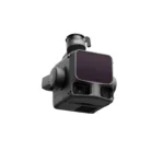
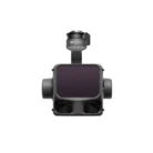
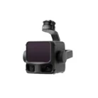


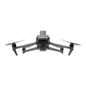
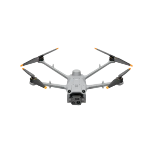
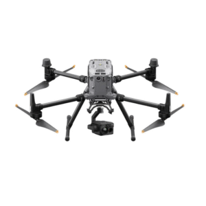
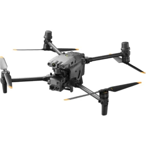
DJI Zenmuse L3 LiDAR Gimbal Camera
- Secure payment : 100% Fast & Secure Payment
- Fast Shipping : Free shipping
- 24/7 Support Services : Any Time Customer Support
The DJI Zenmuse L3 represents the latest advancement in DJI’s enterprise LiDAR technology, designed for seamless integration with the DJI Matrice 400 and other compatible platforms. Engineered for high-precision mapping, inspection, and geospatial applications, the L3 combines a next-generation LiDAR system, dual RGB mapping cameras, and a high-accuracy IMU to deliver survey-grade results with exceptional efficiency.
Exceptional Precision and Performance
ertical accuracy is better than 3 cm at 120m altitude, better than 5 cm at 300m, and better than 10 cm at 500 m, the Zenmuse L3 enables survey-grade precision across diverse operational environments.
Each system is meticulously calibrated and validated using DJI’s D-RTK 3 Multifunctional Station, ensuring stable and reliable data collection across missions.
Advanced LiDAR System
The L3’s LiDAR module delivers exceptional range and density, featuring:
-
Detection Range: maximum detection range of 950m at a pulse rate of 100 kHz, tested under 100 klx ambient light and on objects with 10% reflectivity.
-
Ranging Accuracy: ±10 mm
-
Repeatability: <5 mm (1σ)
-
Number of Returns: Up to 16 returns at 350 kHz
-
Laser Classification: Class 1 (eye-safe)
Enhanced beam precision — 0.25 mrad divergence — results in smaller spot sizes and greater point density, enabling superior detail in vegetation penetration and complex terrain mapping.
RGB Imaging and Dual Camera System
The integrated dual RGB mapping cameras provide a combined 107° field of view and up to 100 MP photo resolution, allowing users to capture rich visual context alongside LiDAR data.
Each camera features a 4/3 CMOS sensor, 28 mm equivalent lens, and adjustable aperture range from f/2.0 to f/11, ensuring excellent image quality under varying light conditions.
High-Accuracy IMU and POS Integration
The Zenmuse L3 incorporates a high-precision IMU synchronized with the drone’s RTK positioning system. This integration provides:
-
Yaw Accuracy: 0.02° (post-processed)
-
Pitch/Roll Accuracy: 0.01° (post-processed)
-
Positioning Accuracy: 1 cm horizontal, 1.5 cm vertical (RTK Fix)
This level of precision ensures exceptionally accurate georeferencing of point clouds, even in challenging environments.
Enhanced Efficiency and Workflow Integration
Data can be exported in standard formats such as LAS, LAZ, PLY, and PCD, enabling compatibility with common GIS and CAD platforms.
Rugged and Reliable Design
-
Ingress Protection: IP54
-
Operating Temperature: -20°C to 50°C (-4°F to 122°F)
-
Storage Temperature: -40°C to 70°C (-40°F to 158°F)
-
Weight: 1.60 kg (excluding gimbal connector)
-
Power Consumption: 64 W (typical), 100 W (max)
Built to withstand demanding field conditions, the Zenmuse L3 ensures consistent performance in variable weather and lighting.
Compatibility
-
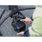
Supported Aircraft: DJI Matrice 400 (requires Zenmuse L3 single gimbal connector)
-
Mounting: Detachable DJI SKYPORT interface
Key Highlights
-
Up to 2000 m detection range and 16-return capability
-
3–5 cm vertical accuracy depending on altitude
-
Dual RGB cameras with 107° combined FOV
-
Integrated IMU + RTK system for precise georeferencing
-
Full DJI software ecosystem support — Pilot 2, Terra, Modify, and FlightHub 2
-
Optimized for survey, inspection, forestry, and environmental monitoring
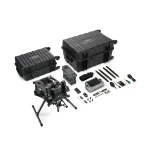
What’s in the Box
-
Zenmuse L3 LiDAR Sensor
-
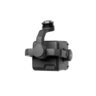
Zenmuse L3 Single Gimbal Connector
-
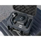
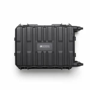
Storage Case
-
4× Gimbal Dampers
-
CFexpress Memory Card
-
CFexpress Type B Card Reader
-
DJI M400 Carrying Case Insert
-
Lens Cleaning Cloth
-
Screws and Tools
Be the first to review “DJI Zenmuse L3 LiDAR Gimbal Camera”
Related products
-

Mavic 3 Multispectral (NA) – SP / 2Y / Plus
Price range: $6,245 through $6,815 -

-

-

MATRICE 350 RTK Single H20T Payload Kit (NA) SP Combo
Price range: $24,345 through $26,235 -

-


 DJI MATRICE 30T (NA) SP
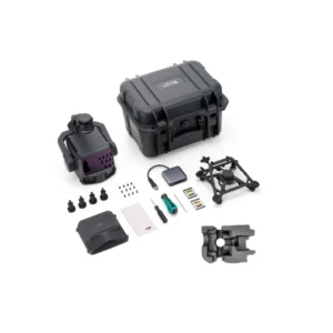
Reviews
There are no reviews yet.